What is Geoconnex?
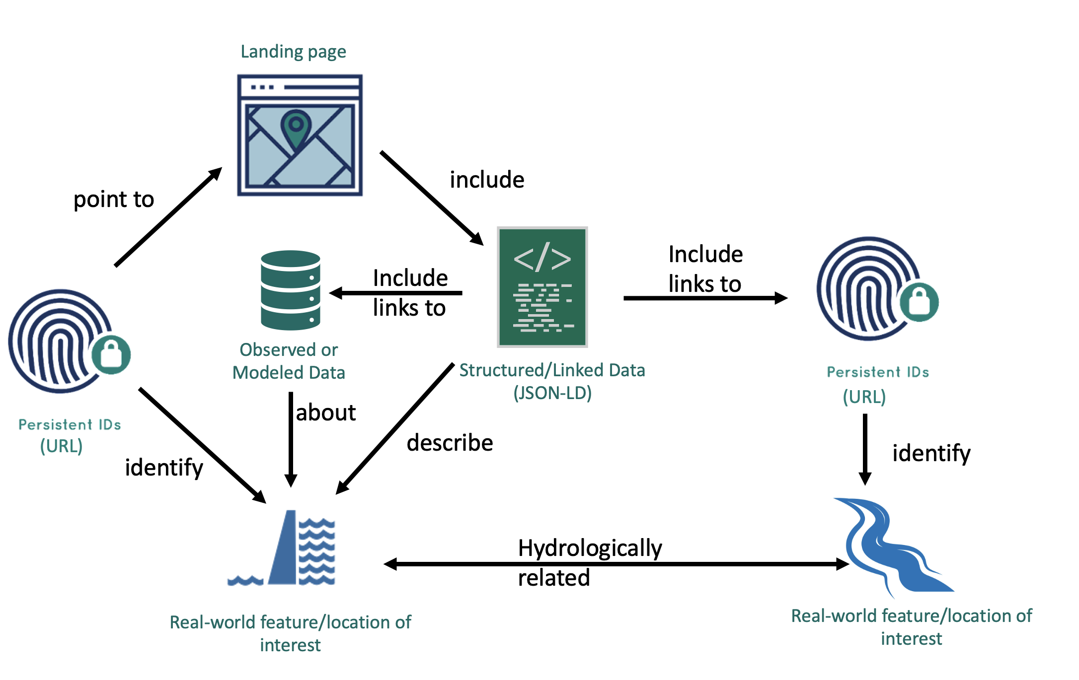
The Geoconnex project provides technical infrastructure and guidance for creating an open, community-contribution model for a knowledge graph linking hydrologic features in the United States, published in accordance with Spatial Data on the Web best practices as an implementation of Internet of Water principles.
In short, Geoconnex aims to make water data as easily discoverable, accessible, and usable as possible.
The Geoconnex knowledge graph is located at https://graph.geoconnex.us and its value can be illustrated considering two use cases:
- Indexing and discovering models and research from public sector, private sector, or academic projects about a particular place or environmental feature.
- Building a federated multi-organization monitoring network in which all member-systems reference common monitored features and are discoverable through a community index.
tip
See the access data section for examples of the data discovery and access workflows that Geoconnex enables.
The development of geoconnex.us takes place on GitHub. See here for the system of repositories.
How the Graph is Populated
- An partner organization creates an endpoint for their water data and associates a list of persistent identifiers with their endpoints
- The organization submits a pull request or submits the form at register.geoconnex.us to upload their data
- The Geoconnex harvester finds the endpoints via their published PIDs and downloads the JSON-LD for each endpoint
- Using the JSON-LD data, the Geoconnex crawler produces semantic triples in the PROV Ontology
- The Geoconnex crawler populates the Geoconnex graph database