Community Landscape
The geoconnex.us project is imagined to be a community open-source project with both code and data contributions from a wide variety of entities with interests in the water sector, including:
- federal, state, and local government agencies
- academic institutions and consortia
- nongovernmental organizations
- private sector organizations
- interested individuals

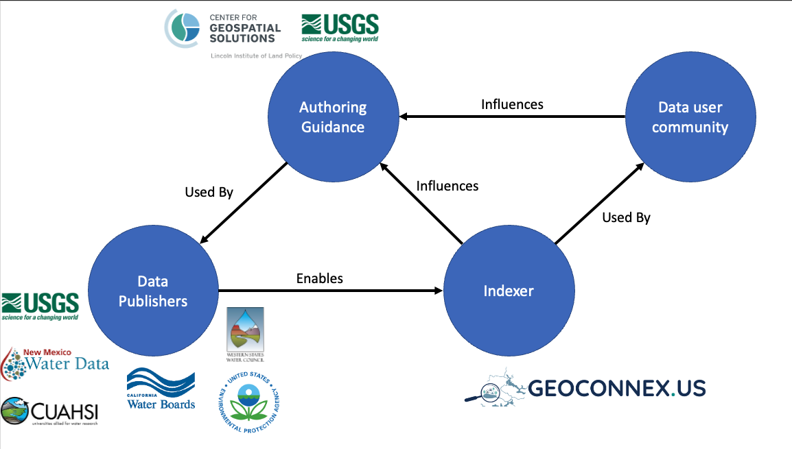
The above diagram illustrates the various roles in the geoconnex.us community. The geoconnex.us knowledge graph begins fundamentally with a community of data publishers who publish their water-related data on the web following W3C Spatial Data on the Web Best Practices. To do so, data publishers require relevant guidance specific to water and water-related domains in terms of what specific metadata needs to be published and in what format. The geoconnex.us authoring guidance being developed here at docs.geoconnex.us serves this purpose. Data publishers that follow this guidance enable the harvester to assemble the decentralized network of published data into a knowledge graph which data users can interact with through search interfaces such as search.geoconnex.us or with web services under development such as reference.geoconnex.us. Data users help the geoconnex.us developers design the authoring guidance by defining the types of queries (and required metadata) that are useful to them.
Indexer
The geoconnex.us infrastructure and development pipeline is administered by the Center for Geospatial Solutions (CGS) at the Lincoln Institute of Land Policy (LILP). LILP is a 501(c)3 nonprofit operating foundation dedicated to efforts to "improve quality of life through the effective use, taxation, and stewardship of land". CGS is a center at LILP dedicated to helping organizations leverage geospatial technology and data for such efforts through research, tool development, and technical assistance.
Developers
geoconnex.us is based on a variety of open-source software as well as open community standards in the geospatial and earth and water science sectors, and all development is managed in public GitHub repositories open to community contributions. However, staff at CGS and the United States Geological Survey (USGS) lead development on technology and documentation specific for the project. The USGS supports development via cooperative agreement under Grant Nos. G21AP10607 and G21AC10732.
Data Publishers and Users
A growing group of organizations have contributed to the geoconnex.us system. They collaborate through communicating about guidance requirements as they publish data to the system, as well as potential use cases for the knowledge graph. We encourage anyone interested to participate. Some contributors include: